
Villanova Human Mobility Data Lab (NovaMobility)
The NovaMobility Lab conducts leading-edge transportation big-data research and delivers high-standard data products. The Lab hosts, ingests, fuses, and integrates terabytes of location-based service data records and trajectories, producing/visualizing the U.S. nation-wide and international human mobility and travel behavior patterns to support various multidisciplinary collaborative research efforts including transportation economics, built environment, pandemic monitoring and prediction, and mobility and health. Several on-going signature projects at the Lab are highlighted on the "Research Projects" tab.
The Lab builds in-house computing cluster and cutting-edge big-data architecture (e.g., Spark, Hadoop, HBase, Docker, Apache Sedona) to efficiently conduct data-driven research and develop data/software products. In addition, the Lab leverages Villanova College of Engineering high-performance computing (CoE-HPC) cluster, a key research tool that provides College researchers with the computational resources they need to succeed in their research programs. These computational resources ensure a swift delivery of research findings and sample data products as well as superior scalability for large-scale industrial solutions to the Lab's clients.
Example research and data products of the Lab include the following:
| Population Flow | Multimodal Mobility | Human Activities |
|---|---|---|
| Number of people or trips traveling between any origin-destination (OD) pair within the U.S. or globally. | Vehicle, rail, air, pedestrian and bicycle trip details. | Human mobility, activities, and population density at different point-of-interests (POIs). |
Example product: The Lab was part of the Next Generation National Household Travel Survey (Next-Gen NHTS) National OD Data project, funded by USDOT FHWA. Several Lab members led the development of cloud computing infrastructure, AI and data-driven algorithms of the project, establishing a more continuous travel monitoring program with national and local data products. More information of the project can be found at https://nhts.ornl.gov/od/.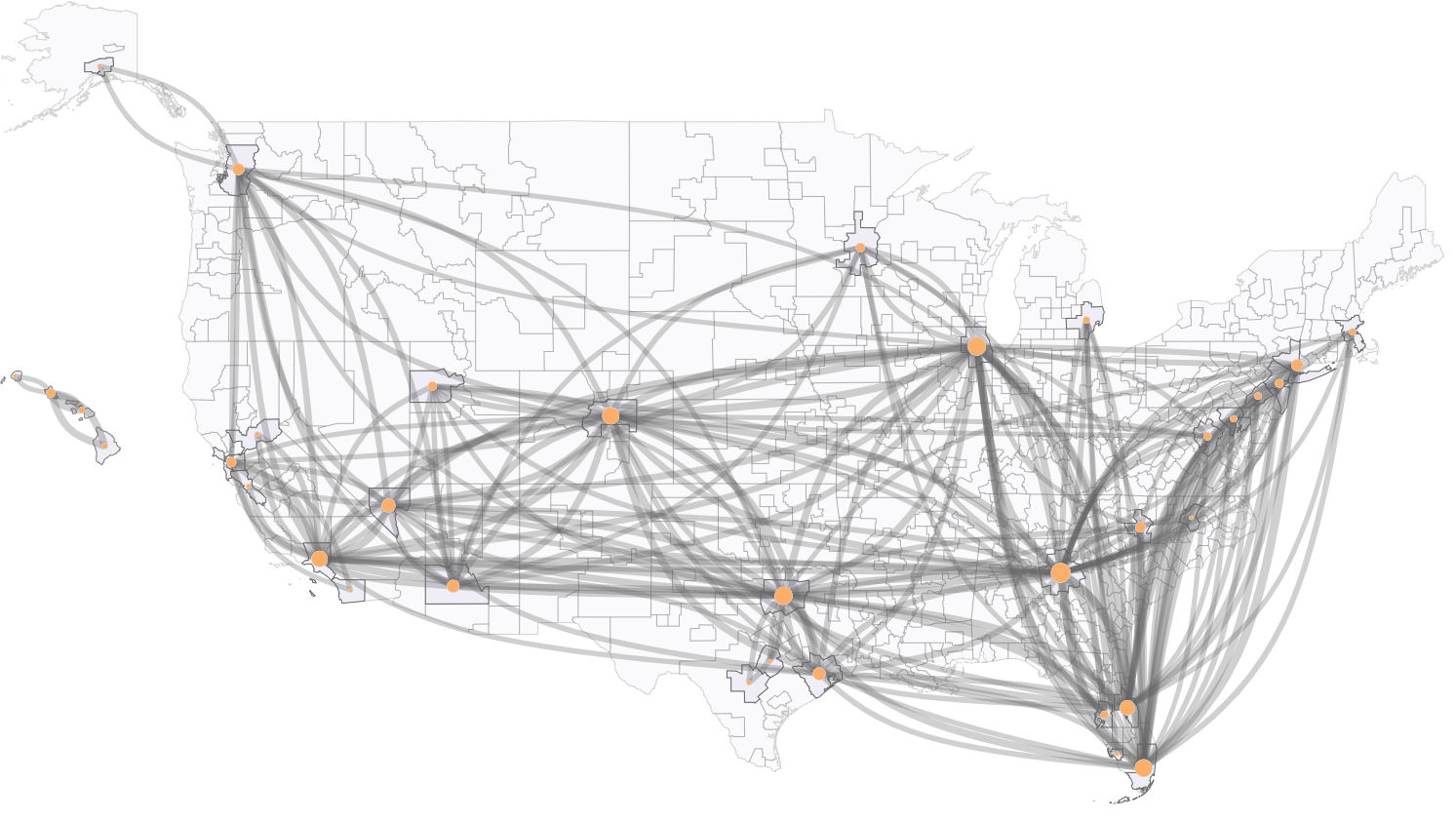 | Example product: Vehicle, pedestrian and bicycle volume estimation via a project sponsored under the USDOT Safety Data Initiative (SDI) in collaboration with Maryland DOT State Highway Administration. The Lab researchers have also deployed a prototype web-based tool to host the data and accomodate various analytics. Results have been tested and validated against available road counts and turning volumes.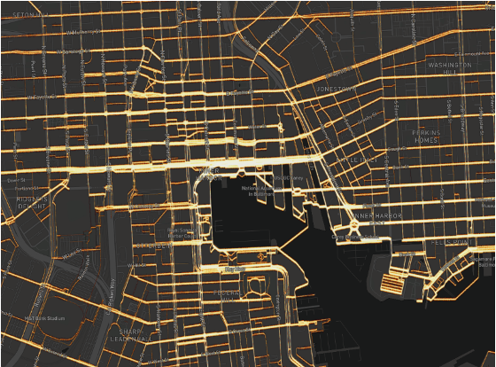 | Example product: Human mobility, activities, and population density in South Africa and Nigeria during the SARS-CoV-2 pandemic, sponsored by National Institutes of Health (NIH) in collaboration with Institute of Human Virology Nigeria, University of Maryland Baltimore, etc. The international mobility measurements produced by the Lab are new and have filled a major data gap in understanding the travel behavior change during the SARS-CoV-2 in Nigeria and South Africa.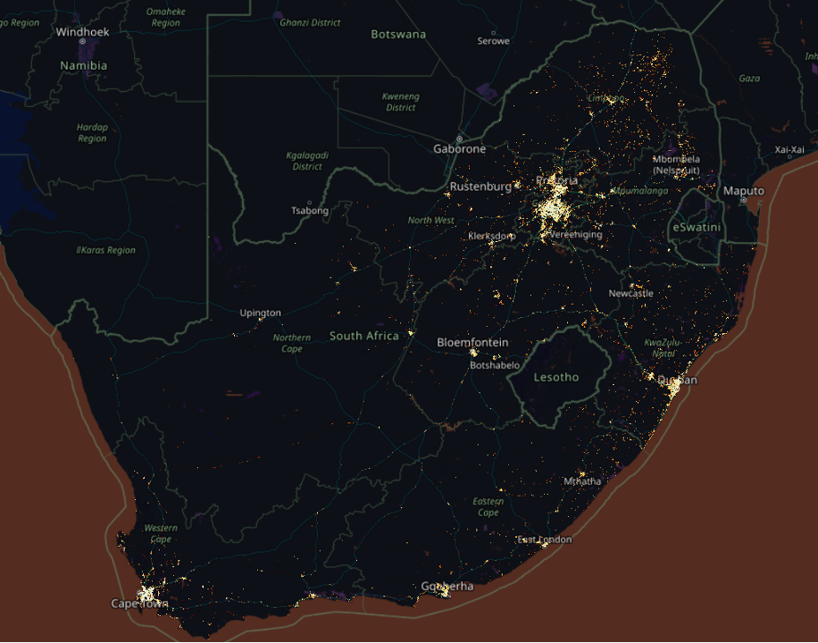 |